By Steven Strong
Contributing Writer for Wake Up World
Adam’s Garden
Barely a fortnight after our research team spent two days on site investigating the standing stones and smaller mound at the ancient site outside Mullumbimby, Adam Pippen, one the Original Custodians who spent both days with us, sent copies of two photographs of a new site he had found.
There is no word that adequately describes how Adam discovers any of the many amazing sites and artefacts he has been drawn towards. He is an Original man steeped in Old Lore and sensibilities, he glides through the land, no matter how daunting the incline or foothold, with an ease and connection to place that demands respect. Intuitively sensing its presence, Adam is called to an object or location well before sighting it. So too, in this case, while paddling along a creek within earshot of the waves crashing against the shore, he came upon the remains of an extremely ancient site.
The two photographs of the shaped rocks Adam sent our team were identical to the rocks at the mound, but separated by some considerable distance. And there was talk of much, much more. Adam also made reference to some sort of wall, but he was a touch obscure. As I was to find out later, he had deliberately understated what he had found: a series of stone arrangements that I still have trouble placing in context.
[pro_ad_display_adzone id=”110028″]
Reaching the site took a little over an hour of paddling along a creek that ran adjacent to a beach. The creek is salty and both banks are lined with mangroves or sand with a few stands of volcanic rock. We could always hear the waves crashing, all that varied was the volume. It was only when the surf was at its loudest did I first sight our target. Positioned at zero elevation within a massive caldera, surrounded by igneous rock and sand, my primary focus was the exotic nature of these sandstone imports. And there were thousands upon thousands to choose from, and there were many other types of rocks present, which only added to the intrigue. But all of that was overshadowed by the thousands of rocks bearing flat lines, smooth faces and sharp hardened edges.
Just like the stones found on, and between, the two mounds some distance away, many of these rocks were also shaped and yet showed no evidence of the characteristic percussion points associated with Original rock-on-rock technology. A more sophisticated tool, at the very least a steel blade, was an essential part of the technology used to shape these rocks.
What was even more remarkable was that unlike the ‘standing stones’ site, which is nearly all sandstone, this site contained an extensive sampling of all manner of sedimentary and igneous rocks, some we have never seen before. Present on site is sandstone that is coloured white, yellow, grey and read, and combinations thereof. Equally, there is a substantial variation in the hardness of these sandstone rocks. Some rocks can break in the hand, while others require a blade just to scratch the surface. Basalt, igneous rocks of many types, conglomerates, some close to 30 centimetres in diameter, quartz and other rocks we had great difficulty in identifying, were spread all over the site.
This raises the question: Even if every engraving and shaped rock was the outcome of natural forces, why is it there is such an incredible array of rock types in one specific location surrounded by mangroves and sand? Undeniably, under any normal setting this combination of rocks could never be found together, the Laws of Nature will have it no other way. All we can state with certainty is that outside human intervention and transportation from elsewhere there is no geological explanation available.
The Guide to Truth
For the purposes of this article, we have chosen eight samples to analyze. In each case, and so many others, they show a variety of features that are either examples of the rarest geological events on the planet or evidence of very sophisticated ways of shaping rock – we believe as a means of communication.
We are mindful nature is capable of creating all manner of irregularities and shapes. But even so, the concentration of so many rocks with no similar samples to be found anywhere nearby, complimented by the variation in rock arrangements spread above and all around the only elevated land in the area, adds credence to the possibility this is the result of human activity. Commentaries aside, I believe the rocks speak for themselves.
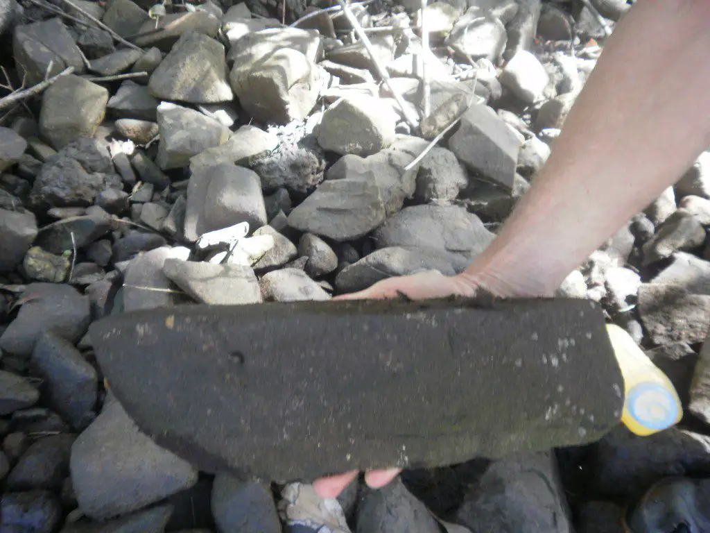
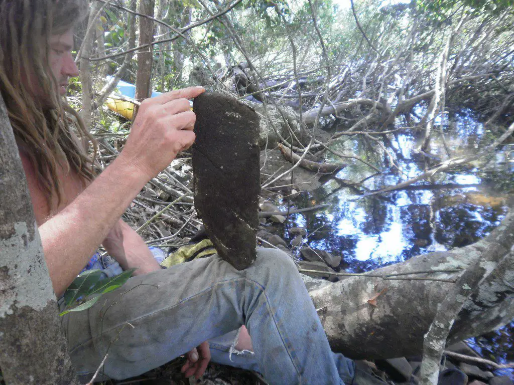
Photograph 1: This triangular sandstone rock is 35 cms long and has a near perfect 180 degree flat side. The two top edges are parallel, with a triangular right edge and flat underside (not shown in photograph). All three faces are very smooth and level.
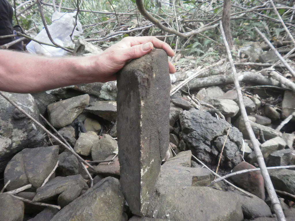
Photograph 2: A semi-rectangular sandstone block with one diagonal edge, 32 cms high, 12 cms long and 5 cms wide. The two featured edges are both at 90 degrees, parallel to each other, and all four faces are flat and level.
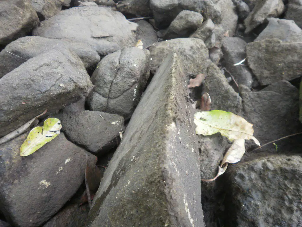
Photograph 3: A triangular sandstone rock with straight lines, precise angles and a sharp top edge. All three sides are flat and even, and the top edge is 38 cms long. To the left is a rock with what looks like an engraved curved cross. Not only is the marking extremely deep and unusual, it corresponds identically to one of most important symbols of the Sacred Language, as Slater documented. As mentioned previously, the words of the first language words can have many meanings; this sign means “B*********,the Guide to Truth” [*] and can also represent the number nine.
What is as interesting as it is intriguing, is that a high proportion of the shaped rocks at this site appear to have a flat base, sometimes quite small, which is capable of balancing the weight of the rock upright. What is of even more interest and deserving of extensive research are the rocks exhibiting deep incisions, patterns, engraved lines and symbols.
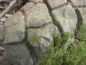
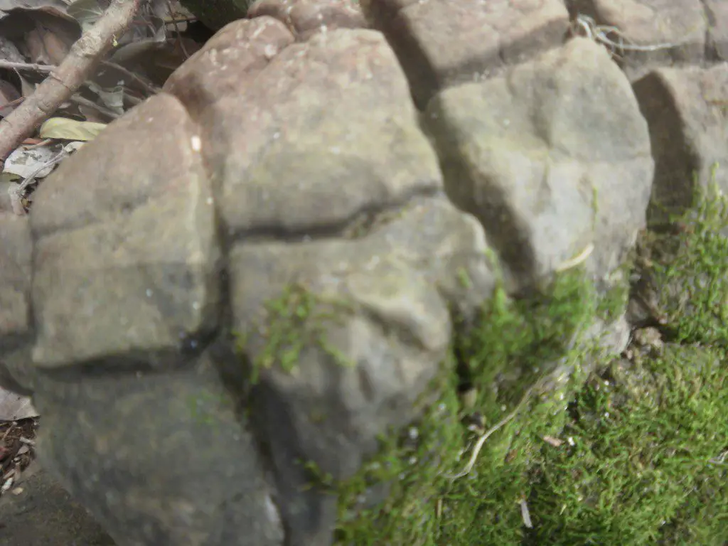
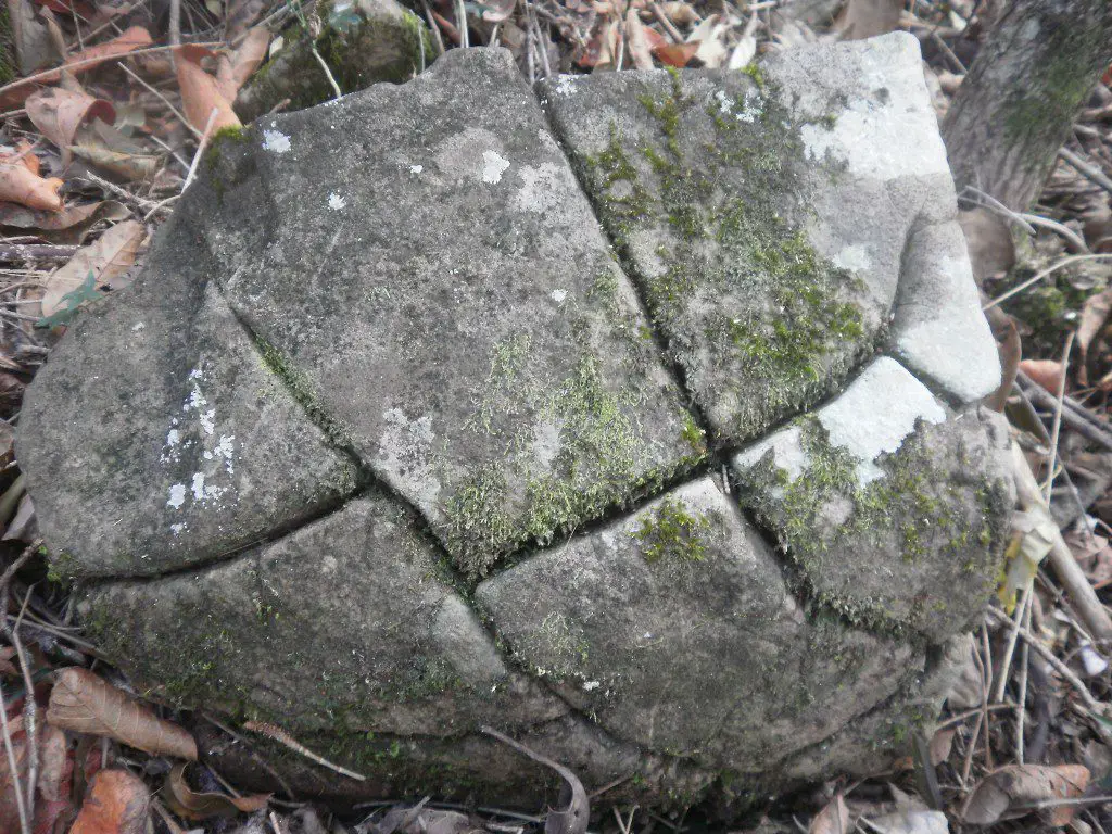
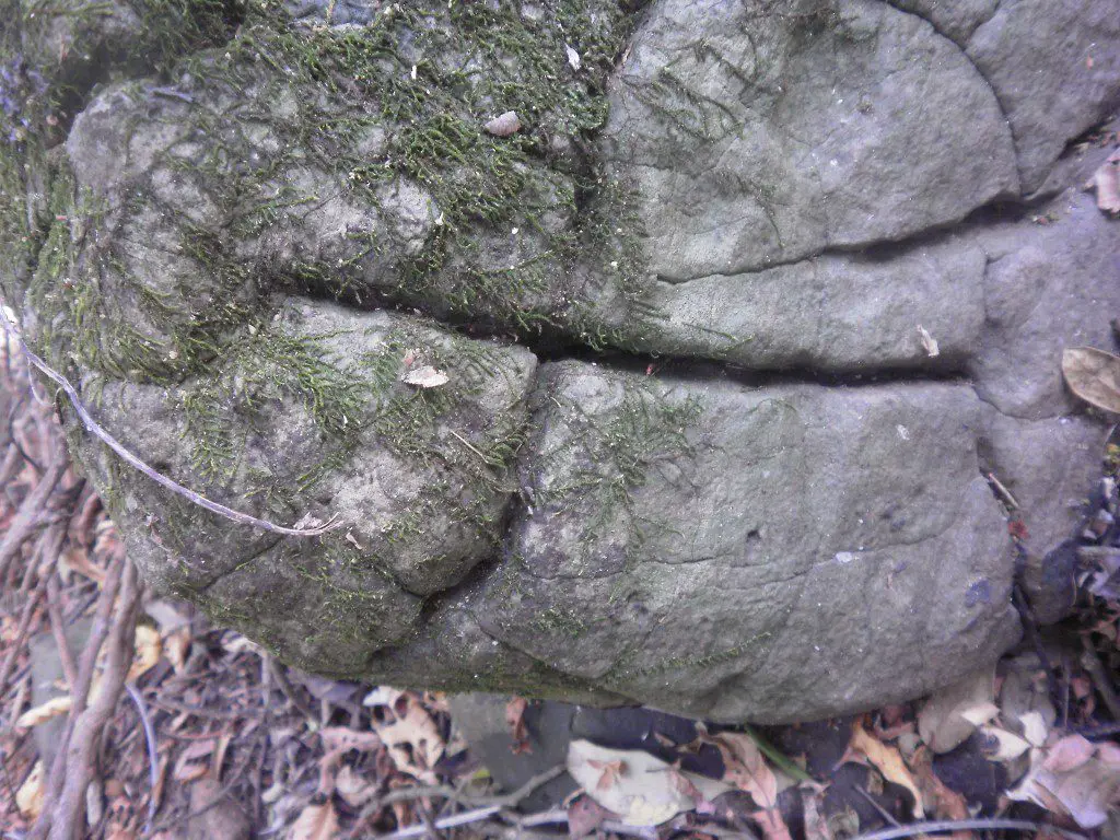
Photograph 4: This rock is divided into eight distinct sections, the incisions or fractures are extremely deep, but as with other rocks there is no sign of any cracking on the flat unmarked base. We believe that there was no natural agency responsible.
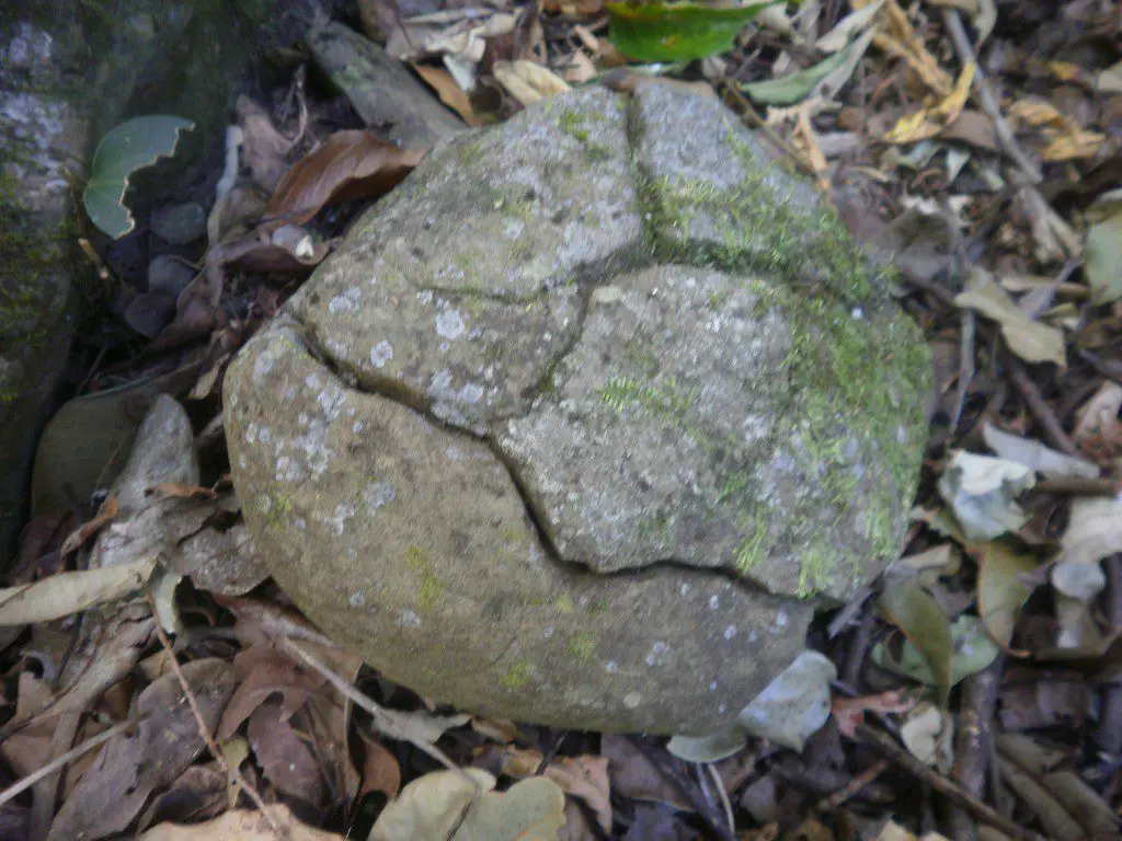
Photograph 5: This rock has a very flat level underside, without any marking or fracture, yet has over 40 segmented sections on the curved topside. Each has been separated by deep incisions into what may be an igneous rock. Being much harder than sandstone, this only accentuates the reality that only the hardest and most durable metal tools could create such incisions. It measures 24cms by 24 cms at its widest, and there seems to be a discreet symbol/Original letter in the bottom right hand sector, and the possibility of another symbol just above the centre.
Photograph 6: This sandstone rock is also flat underneath and quite smooth, and was engraved into five parts. The most interesting cut is the deepest; it stops at both edges and there is no trace of it continuing on the other side. To engrave so deeply into sandstone and cause no further fracturing takes a real degree of skill, and the use of sophisticated metal tools with very fine blades.
Photograph 7: Another sandstone rock engraved into segments, eight on this occasion. What is particularly interesting is the V shape on the right side, past the point where both carved lines stop there is no further cracking.
Photograph 8: An engraving that again appears to signify “B*********, the Guide to Truth”. The deep incisions in the sandstone rock show no evidence of fracturing underneath. There are a few fine cracks running off this incision. The depth of engraving is again indicative of a fine touch with a powerful metal blade.
Standing on The Jetty
Shaped rocks aside, there is still so much more to this complex. The quantity and variations of stone arrangements is as massive as it is overwhelming. There was so much going on here, and at this stage anything beside the most basic deductions is beyond our present brief. There are rock walls, circles, lines of rocks and arrangements that don’t have any academic label. There are rocks weighing hundreds of kilograms that have been moved some distance, others were stacked, while some rocks were positioned in single lines.
We had less than three hours on site, and nearly all of our time was devoted to roaming through forest and slope, getting an overall picture. And that task was nowhere near completed. No measurements were taken, and I have only a rough estimate of the number of rock alignments, walls, tracks, direction markers etc. featured at this site. We took no rock count, nor even the crudest map of the shore or surrounding area. I had intentions of at least putting pen to paper, but the scope, intricacy, volume and diversity of what unfolded – and continued to unfold – left no time for anything more than to walk, watch and witness this ancient parade.
Passing any judgement, until more archaeology is done, is fraught with retractions and further additions. But nevertheless, upon reflection there seem to be a few possibilities that could provide a base upon which further archaeology may confirm (or contradict).
There is a piece of land, primarily sandstone bound by soil, which juts out into the creek over 9 metres. It is not natural; such a massive accumulation of exotic stones, deliberately placed to form a location at which boats could moor, is just not part of nature’s plan. Our suspicion – that this site was an ancient port from which the sandstone and other objects were transported inland – also seems consistent with the immediate surrounds. What we feel is a very old road begins no less than five metres from the pier and rises diagonally up the only sizeable hill that fronts this creek. If the sea level was five metres higher, this elevated section would front the sea, and would be the only piece of land for kilometers in any direction to remain dry.
We believe the sandstone rocks, along with the many other types of rock, were transported to this site and found no direct evidence that this was the actual location where the stone was worked. We found no discards, rubble or half-worked pieces of stonework that didn’t measure up to the tool-makers high standards.
An extremely high percentage of the smoother worked stones, of which there are thousands, are located beneath and just above the bank. It would appear there is a good chance that at an earlier time these rocks may have been part of something much bigger, perhaps a sizeable wall standing on top of the bank protecting the land from stormy seas. We do know that hundreds of years ago a tsunami hit the east coast of Australia, and that the massive surge of water and its eventual return to sea would first topple this hypothetical stone barricade, then pull it back over the bank as the water recedes. Such a scenario is in accord with the lay of the stones.
At this stage, until we are offered Original guidance, there is very little I can add in relation to the stone arrangements. After Original counsel, never before, a tally can begin, along with mapping, measuring, estimating weight, directions and alignment. And ultimately we hope to determine a degree of purpose.
Spread over no less than five acres, the thousands of rocks positioned along and beneath the bank were brought from somewhere far off. The rock walls were constructed on site, as was the jetty. As to who was responsible, how and why this was done, and when it occurred, are questions still to be resolved.
* Note: in the reference “B*********, the Guide to Truth”, the name has been withheld out of respect to the Original people and sacred lore.
About the author:
 Steven Strong is an Australian-based researcher, author and former high school teacher. Together with his son Evan, his work is to explore the ancient story of the Original people, a narrative that was almost lost to aggressive European colonisation.
Edited and additional commentary by Andy Whiteley for Wake Up World.
This article and all images contained herein © Adam Pippen. All rights reserved.
[pro_ad_display_adzone id=”110027″]

