By Steven Strong
Contributing Writer for Wake Up World
Being a devout life-long non-swimmer, every boat journey back to the site my team calls ‘Adam’s Garden’ is laced with equal lashings of anticipation and dread. Reaching the site requires over an hour of paddling along a salt water creek that runs adjacent to a beach.
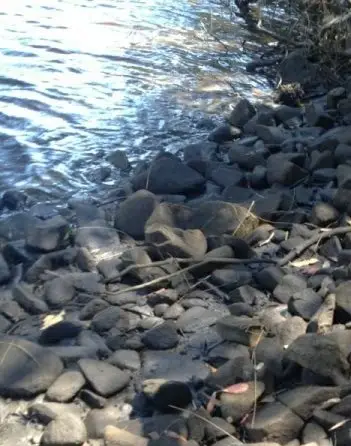
Surrounded by sand, salt water, dunes and mangroves, there is nothing about Adam’s Garden that is natural. The 185 metre spread of rocks, numbering in the tens of thousands, is laid below, on and above the shore line, and bares no natural relationship to any part of the creek bank or nearby geology.
The smaller igneous and metamorphic rocks near the creek, although not part of the immediate surrounds, are part of the geology of this ancient caldera.
However, the same cannot be said for the assortment of fine and coarse grained sandstone. We have seen on site smaller grained sandstone rocks coloured white, red, brown, grey and yellow. And yet the closest known large deposit of fine grained sandstone is on the coast some 20 kilometres to the south – one of many challenges we have explaining this site. Some of the coarse-grained sandstone, which could not have been taken from this nearby site, has sizeable chunks of quartz embedded amongst the much larger particles. It appears that the bigger sandstone particles were first deposited when the turbulence and flow was at its most rapid and must have taken place some distance from the coast. The many large conglomerate rocks found in this mixed load are also imports, as are many other rocks we are still unable to positively identify.
[pro_ad_display_adzone id=”110028″]
It is the huge variety and quantity of rocks, sourced from so many different geological regimes, that make this site so intriguing.
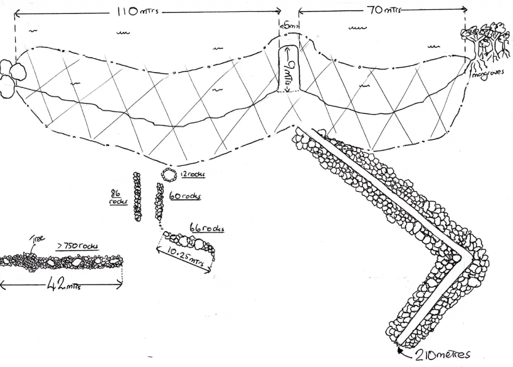
What stood out the first time I stood on site was the ‘jetty’ or ‘pier’. There is no other way of describing this elevated section of the bank, made from sandstone rocks. There appears to be no natural reason that could account for the accumulation of hundreds of sandstone rocks jutting out into the creek. But in this case, with the exception of a ‘sprinkling’ of quartz, my team has not found a single ‘non-sandstone’ rock in this 9 metre by 5 metre construction.
Adding to the mystery is what seems to be a massive construction involving the placement of thousands of tonnes of igneous rock above and below a ‘road’ which begins just to the south of the jetty. Exhibiting a consistent width of 2 metres as it curves up a slope from the jetty to the top of the rise (elevation 35 metres), this section of road measured 210 metres. But we hadn’t finished, as there was more road ahead. All the rocks were igneous, and quite a few weighed hundreds of kilograms and some weighed over half a tonne. There is no contemporary record of such a huge collection of rocks placed below and above a road or any like construction. The repeated stacking of rocks to maintain the integrity of this road seems in contradiction to the randomness of any bulldozer blade, and more in keeping with human hands or tools. Moreover, outside mud- crabbing, the mangroves and sand provide no economical incentive to construct a rudimentary track, let alone a road of such proportions.
As mentioned previously there is an abundance of all manner of Original stone arrangements. On our second time on site, we decided to begin our research by focusing upon two rock arrangements found on the northern side of the jetty.
The Original stone arrangement closest to the jetty seems to be made of three sets interrelated rock walls/alignments, all have some sections where the rocks are stacked, and together they lead down the slope towards a simple circle of 12 rocks, which is within metres of the creek. The first part of this layout begins with wall/line of rocks measuring 10.25 metres. With the exception of the southern section of the wall, which curls up the hill and points directly towards a striking igneous outcrop of about 4 metres height and 5 metres across, the main body of rocks were aligned in a straight line 38 degrees to the south west. There are 66 rocks in this first line, and what doesn’t seem coincidental is that before finally veering up the hill, if maintaining the line the majority of rocks point towards, it is pointing directly towards a second igneous boulder of similar dimensions. In our opinion this rock arrangement’s primary role was to deliberately highlight both huge boulders which more than likely are of great significance to Original sensibilities.
There is gap of about 5 metres where three rocks seem to connect the upper rock line to the two lower groups of rocks and the 12 rocked circle. Both face east 105 degrees, the arrangement closest to the first wall has 60 rocks and the northern wall 86 rocks, and they are one metre apart. The rock circle is two metres from the smaller rock arrangement and very close to the creek.
The two smaller lines of igneous rocks (8 and 10 metres in length) vary in weight from about one to ten kilograms. We believe that the higher wall is obviously the centre point, and there are by our estimation, at least nine rocks weighing over 100 kilograms. In what only adds to the difficulties in logistics and construction, one of the rocks in this arrangement weighs no less than a half a tonne.
The second rock line of rocks we examined is simpler in design, much longer and far bigger. Such is the quantity and variation in size, an approximate count of 750 is a bare minimum. Measuring 42 metres and only 3 degrees off north, there are 6 rocks weighing over 100 kilograms and one over 500 kilograms.
Of no less interest, but certainly more open to interpretation, is the huge array of rock markings. There are literally thousands of rocks that exhibit all manner of markings, depressions, incisions, lines and ‘bulbs’ which are spread along the shore-line and further up the slope. Without doubt some of these markings are due to natural agents, but where do we draw the line? Even if every rock bearing some type of depression or fracturing is indeed natural, caused by a large variety of geological forces, why is it all of these many different marked rocks are found within this intensive cluster down by the sea surrounded by sand?
The real problem is that, if this is all simply down to nature, some of the fractures are extremely deep. Many incisions cut through more than half of the rock and show no evidence of further cracking or fine lines, neither on the underside nor past the point where the depression stops. In some cases – clean cuts of consistent depth with no residual effects with no prospect of the fractures extending – we feel only a metal tool or something even more sophisticated was responsible.
What is even more problematic is the huge selection of so many apparently shaped stones; sandstone rocks with straight lines, edges and flat sides.
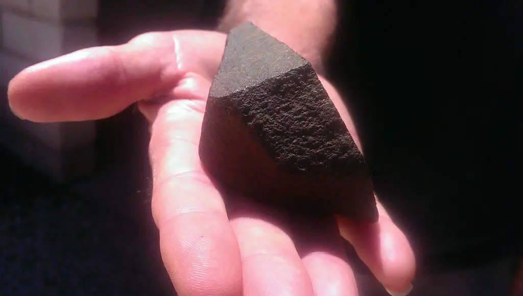
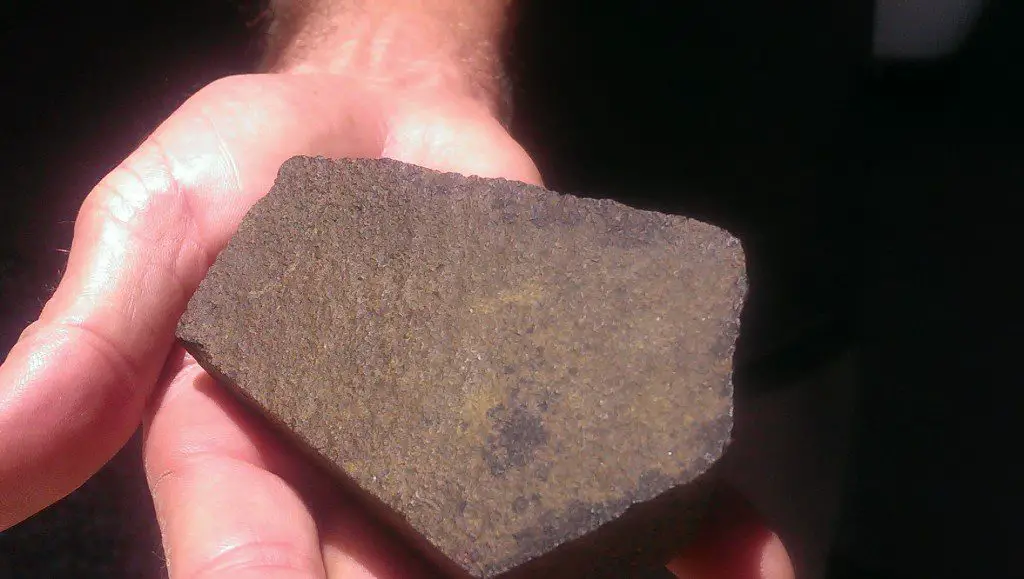
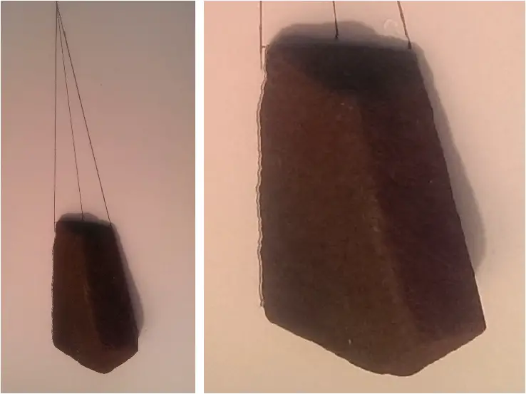
Undeniably some of these rock’s features are due to natural factors, but many rocks feature so many flat sides, sharp angles and straight lines that our understanding of natural processes defies their explanation. In every case, not a single rock we examined displayed any semblance of a percussion point, the effect of a hammer-stone being used in rock shaping. No indentation was visible, nor for that matter was there any indication of a chisel mark or impact of any metal blade. Knowing as we do now that shaped stones just like these were a device used to convey language, directions and heavenly knowledge etc., it is not that easy to dismiss any stone with straight angles and flat sides – none more so than the photograph supplied of a small rock found on-site.
The narrower ‘top’ section of the rock has broken off some considerable time ago. It would seem this shaped rock tapered off to a peak, with all four faces and lines converging to the same shared point. The fact that this artefact can rest on a separate thinner base and yet remain parallel to the lines traced out on the wider base and converge at exactly the same point exhibits a symmetry that is rarely, if ever, part of Nature’s plan. It had, and still does, seven sides. Three faces are at, what we assume to be, the thicker back-section, and from that base there four sides, of which three of the edges running forward are still quite sharp. It seems logical to assume the more weathered sides and faces were also just as acute and smooth when first constructed. Neither percussion nor blade point can be seen, and even the concept of a non-iron blade shaping this rock is an extremely difficult proposition to accept.
Another anomaly peculiar to this site, is the puzzling diversity of micro eco-systems growing within the 5 acres we have investigated. Flanked by mangroves, there are discreet stands of palms, grass trees, lawyer cane, eucalypts, lamandra, paper barks, salt tolerant rainforest trees along with other thriving rainforest trees and vines that are supposedly sensitive to salt water or air.
A partial explanation can be found within an explanation Original custodian Adam Pippen made quite recently. At the shoreline to the south of the jetty he noticed stands of lamandra and lawyer cane on the bank, literally within a metre of the salt water. The fresh water seeping underneath this area rise and flow into the creek would certainly account for this to occur. The dilution of salt water may explain why the mangroves were absent and why the lamandra and lawyer cane grew so close to the edge while many of the diverse stands of vegetation are much higher up the bank.
At this stage of developments there are very few, if any, definites beyond acknowledging a trail of irregularities. In the simplest terms there are far too many rocks which are too varied and marked, the geology on display is too close to the ocean and too much at odds with the immediate geography. As to why, when, who or what was responsible, the jury is still out and most of the evidence is yet to be collected and collated. Until those tasks are completed it would appear passing any definitive commentary or conclusion would be unwise.
Nevertheless, once this site is placed into context and in association with the 185 Standing Stones, the ancient road (probably Egyptian or older) in the Nightcap National Park and other sites in the general vicinity, what is consistent is the evidence of a highly sophisticated technology and activities outside the scope of any Original rock and stick tool-kit. In my team’s opinion, there is at the very least an ancient Egyptian connection on display, but we feel much of the archaeology reaches much further back in time.
Whether the relics and activities are sourced from earlier Homo sapien or erectus communities, the fabled Lemurian civilisation or outsourced to the Plieades, is a moot point. What can be stated with absolute confidence is that, wherever the archaeology leads us, the answer will not be found in any ‘accepted’ Australian text book or curriculum dealing with Original pre-history.
About the authors:
 Steven Strong is an Australian-based researcher, author and former high school teacher. Together with his son Evan, his work is to explore the ancient story of the Original people, a narrative that was almost lost to aggressive European colonisation.
Editing and additional commentary by Andy Whiteley for Wake Up World.
This article and all images contained herein © Adam Pippen. All rights reserved.
[pro_ad_display_adzone id=”110027″]

